WSentinel capture software creates 3 primary event files; composite jpg, video(.mp4), and a spreadsheet(.csv) which contains a timehistory of energy, azimuth/elevation, and pixel mapping for the event as seen from the camera location: (see Spreadsheet Column Definitions here).
NOTE: The az/el data in the spreadsheet are approximations and offline calibration is required for refined assessments. Refined calibrations require use of the nightly composites which are available via the link on the right side of this page.
If you don't see an event, or you are looking for data over 30 days old, please contact us at: 
Node Events (last 30 days)
|
|
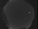
Date: November 2 2025
Time: 12:35:58.91 UTC
|

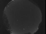
Date: November 2 2025
Time: 12:15:08.414 UTC
|

Date: November 2 2025
Time: 07:08:44.694 UTC
|

Date: November 1 2025
Time: 12:53:31.791 UTC
|
Date: November 1 2025
Time: 11:00:02.910 UTC
|

Date: November 1 2025
Time: 10:53:47.540 UTC
|

Date: October 31 2025
Time: 06:53:08.882 UTC
|

Date: October 30 2025
Time: 11:09:47.745 UTC
|

Date: October 30 2025
Time: 07:13:29.857 UTC
|

Date: October 30 2025
Time: 06:18:04.487 UTC
|

Date: October 29 2025
Time: 11:48:53.769 UTC
|

Date: October 29 2025
Time: 11:48:50.928 UTC
|

Date: October 29 2025
Time: 11:48:47.949 UTC
|

Date: October 29 2025
Time: 11:48:45.80 UTC
|

Date: October 29 2025
Time: 11:48:42.209 UTC
|

Date: October 29 2025
Time: 11:48:39.409 UTC
|

Date: October 29 2025
Time: 11:14:57.122 UTC
|

Date: October 29 2025
Time: 10:53:12.509 UTC
|

Date: October 29 2025
Time: 10:52:59.559 UTC
|

Date: October 29 2025
Time: 10:47:29.925 UTC
|
|
