WSentinel capture software creates 3 primary event files; composite jpg, video(.mp4), and a spreadsheet(.csv) which contains a timehistory of energy, azimuth/elevation, and pixel mapping for the event as seen from the camera location: (see Spreadsheet Column Definitions here).
NOTE: The az/el data in the spreadsheet are approximations and offline calibration is required for refined assessments. Refined calibrations require use of the nightly composites which are available via the link on the right side of this page.
If you don't see an event, or you are looking for data over 10 days old, please contact us at: 
Node Events (last 30 days)
|
|
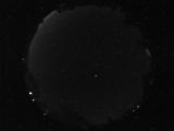
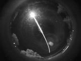
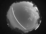
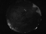
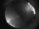
Date: June 19 2026
Time: 11:06:01.166 UTC
|
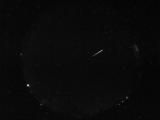
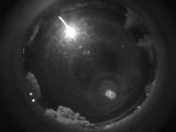
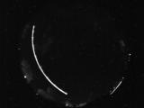
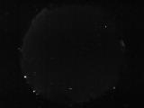
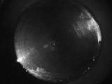
Date: June 19 2026
Time: 09:09:49.844 UTC
|
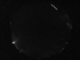
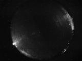
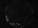
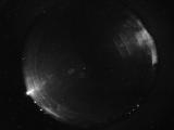
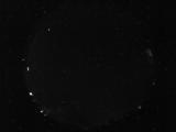
Date: June 19 2026
Time: 05:41:46.967 UTC
|
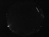
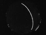
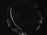
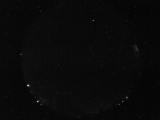
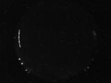
Date: June 19 2026
Time: 05:41:42.467 UTC
|
Date: June 19 2026
Time: 05:38:20.280 UTC
|
Date: June 19 2026
Time: 05:38:12.373 UTC
|
Date: June 19 2026
Time: 05:03:20.510 UTC
|
Date: June 19 2026
Time: 04:57:00.213 UTC
|
Date: June 19 2026
Time: 03:28:17.351 UTC
|
Date: June 18 2026
Time: 08:40:47.685 UTC
|
Date: June 18 2026
Time: 05:36:51.897 UTC
|
Date: June 18 2026
Time: 05:36:37.350 UTC
|
Date: June 18 2026
Time: 04:35:22.457 UTC
|
Date: June 17 2026
Time: 10:57:39.779 UTC
|
Date: June 17 2026
Time: 06:05:06.528 UTC
|
Date: June 17 2026
Time: 06:00:08.404 UTC
|
Date: June 17 2026
Time: 04:43:23.347 UTC
|
Date: June 17 2026
Time: 04:43:13.222 UTC
|
Date: June 16 2026
Time: 09:10:21.323 UTC
|
Date: June 16 2026
Time: 06:55:49.360 UTC
|
|
