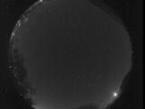
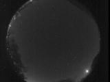
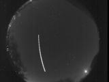
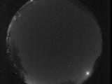
WSentinel capture software creates 3 primary event files; composite jpg, video(.mp4), and a spreadsheet(.csv) which contains a timehistory of energy, azimuth/elevation, and pixel mapping for the event as seen from the camera location: (see Spreadsheet Column Definitions here).
NOTE: The az/el data in the spreadsheet are approximations and offline calibration is required for refined assessments. Refined calibrations require use of the nightly composites which are available via the link on the right side of this page.
If you don't see an event, or you are looking for data over 30 days old, please contact us at: 
Node Events (last 30 days)
|
|
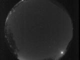
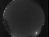
Date: October 29 2025
Time: 05:11:12.435 UTC
|
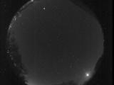
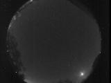
Date: October 29 2025
Time: 05:08:43.905 UTC
|
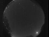
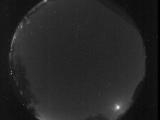
Date: October 29 2025
Time: 05:04:41.548 UTC
|
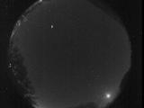
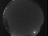
Date: October 29 2025
Time: 05:01:18.399 UTC
|

Date: October 29 2025
Time: 04:58:04.198 UTC
|
Date: October 29 2025
Time: 04:55:16.408 UTC
|

Date: October 29 2025
Time: 04:52:16.48 UTC
|
Date: October 29 2025
Time: 04:48:46.984 UTC
|

Date: October 29 2025
Time: 04:45:23.164 UTC
|

Date: October 29 2025
Time: 04:42:43.694 UTC
|
Date: October 29 2025
Time: 04:39:53.474 UTC
|
Date: October 29 2025
Time: 04:35:47.23 UTC
|

Date: October 29 2025
Time: 04:32:39.226 UTC
|
Date: October 29 2025
Time: 04:29:16.47 UTC
|
Date: October 29 2025
Time: 04:26:34.336 UTC
|
Date: October 29 2025
Time: 04:23:20.926 UTC
|

Date: October 29 2025
Time: 04:20:05.509 UTC
|

Date: October 29 2025
Time: 04:16:36.218 UTC
|
Date: October 29 2025
Time: 04:13:53.739 UTC
|

Date: October 29 2025
Time: 04:10:14.339 UTC
|
|
