WSentinel capture software creates 3 primary event files; composite jpg, video(.mp4), and a spreadsheet(.csv) which contains a timehistory of energy, azimuth/elevation, and pixel mapping for the event as seen from the camera location: (see Spreadsheet Column Definitions here).
NOTE: The az/el data in the spreadsheet are approximations and offline calibration is required for refined assessments. Refined calibrations require use of the nightly composites which are available via the link on the right side of this page.
If you don't see an event, or you are looking for data over 10 days old, please contact us at: 
Node Events (last 30 days)
|
|
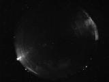
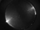
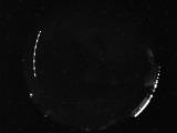
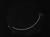
Date: June 16 2026
Time: 06:28:28.91 UTC
|
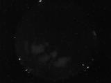
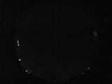
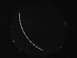
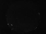
Date: June 16 2026
Time: 05:50:46.409 UTC
|
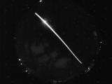
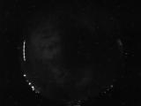
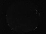
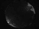
Date: June 16 2026
Time: 05:50:11.940 UTC
|
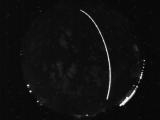
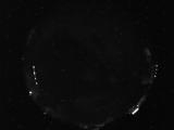
Date: June 16 2026
Time: 05:08:38.703 UTC
|
Date: June 16 2026
Time: 03:45:08.418 UTC
|
Date: June 15 2026
Time: 07:42:02.560 UTC
|
Date: June 15 2026
Time: 06:11:01.290 UTC
|
Date: June 15 2026
Time: 04:37:43.679 UTC
|
Date: June 15 2026
Time: 04:34:29.944 UTC
|
Date: June 14 2026
Time: 08:24:54.405 UTC
|
Date: June 14 2026
Time: 06:02:43.362 UTC
|
Date: June 13 2026
Time: 08:23:58.20 UTC
|
Date: June 13 2026
Time: 08:23:50.20 UTC
|
Date: June 12 2026
Time: 11:30:22.978 UTC
|
Date: June 12 2026
Time: 10:11:18.156 UTC
|

Date: June 12 2026
Time: 09:19:20.366 UTC
|
Date: June 12 2026
Time: 09:19:14.991 UTC
|
Date: June 12 2026
Time: 09:18:45.569 UTC
|
Date: June 12 2026
Time: 09:18:42.897 UTC
|
Date: June 12 2026
Time: 04:56:04.952 UTC
|
|
