WSentinel capture software creates 3 primary event files; composite jpg, video(.mp4), and a spreadsheet(.csv) which contains a timehistory of energy, azimuth/elevation, and pixel mapping for the event as seen from the camera location: (see Spreadsheet Column Definitions here).
NOTE: The az/el data in the spreadsheet are approximations and offline calibration is required for refined assessments. Refined calibrations require use of the nightly composites which are available via the link on the right side of this page.
If you don't see an event, or you are looking for data over 30 days old, please contact us at: 
Node Events (last 30 days)
|
|
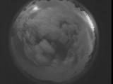
Date: September 5 2025
Time: 06:05:47.726 UTC
|
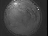
Date: September 5 2025
Time: 06:00:20.116 UTC
|
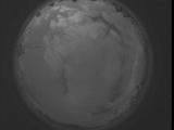
Date: September 5 2025
Time: 05:54:52.577 UTC
|
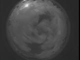
Date: September 5 2025
Time: 05:49:24.957 UTC
|
Date: September 5 2025
Time: 05:43:57.417 UTC
|
Date: September 5 2025
Time: 05:38:29.807 UTC
|
Date: September 5 2025
Time: 05:33:02.257 UTC
|
Date: September 5 2025
Time: 05:27:34.648 UTC
|
Date: September 5 2025
Time: 05:22:07.99 UTC
|
Date: September 5 2025
Time: 05:16:39.488 UTC
|
Date: September 5 2025
Time: 05:11:11.939 UTC
|
Date: September 5 2025
Time: 05:05:44.330 UTC
|
Date: September 5 2025
Time: 05:00:16.789 UTC
|
Date: September 5 2025
Time: 04:54:49.170 UTC
|
Date: September 5 2025
Time: 04:49:21.630 UTC
|
Date: September 5 2025
Time: 04:43:54.21 UTC
|
Date: September 5 2025
Time: 04:38:26.470 UTC
|
Date: September 5 2025
Time: 04:32:58.861 UTC
|
Date: September 5 2025
Time: 04:27:31.281 UTC
|
Date: September 5 2025
Time: 04:22:03.732 UTC
|
|
