WSentinel capture software creates 3 primary event files; composite jpg, video(.mp4), and a spreadsheet(.csv) which contains a timehistory of energy, azimuth/elevation, and pixel mapping for the event as seen from the camera location: (see Spreadsheet Column Definitions here).
NOTE: The az/el data in the spreadsheet are approximations and offline calibration is required for refined assessments. Refined calibrations require use of the nightly composites which are available via the link on the right side of this page.
If you don't see an event, or you are looking for data over 10 days old, please contact us at: 
Node Events (last 30 days)
|
|
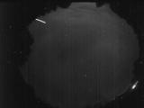
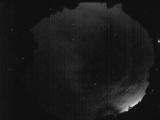
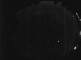
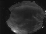
Date: June 20 2026
Time: 03:04:33.255 UTC
|
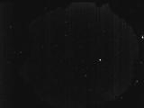
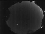
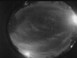
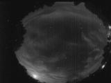
Date: June 12 2026
Time: 03:49:07.0 UTC
|

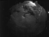
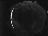
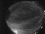
Date: June 11 2026
Time: 22:22:11.592 UTC
|
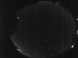
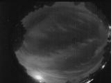
Date: June 11 2026
Time: 22:22:01.913 UTC
|
Date: June 10 2026
Time: 04:43:23.430 UTC
|
Date: June 9 2026
Time: 04:56:50.444 UTC
|
Date: June 7 2026
Time: 03:25:44.861 UTC
|
Date: June 6 2026
Time: 04:14:20.630 UTC
|
Date: June 5 2026
Time: 05:45:36.752 UTC
|
Date: June 5 2026
Time: 02:54:30.73 UTC
|
Date: June 3 2026
Time: 02:24:55.156 UTC
|
Date: June 3 2026
Time: 00:31:48.94 UTC
|
Date: June 2 2026
Time: 02:41:48.548 UTC
|
Date: June 1 2026
Time: 21:27:37.441 UTC
|

Date: June 1 2026
Time: 21:27:34.241 UTC
|
Date: May 31 2026
Time: 02:59:57.319 UTC
|
Date: May 31 2026
Time: 02:56:20.800 UTC
|
Date: May 31 2026
Time: 02:55:25.351 UTC
|
Date: May 31 2026
Time: 02:34:22.730 UTC
|
Date: May 31 2026
Time: 02:32:38.631 UTC
|
|
