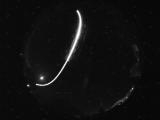
WSentinel capture software creates 3 primary event files; composite jpg, video(.mp4), and a spreadsheet(.csv) which contains a timehistory of energy, azimuth/elevation, and pixel mapping for the event as seen from the camera location: (see Spreadsheet Column Definitions here).
NOTE: The az/el data in the spreadsheet are approximations and offline calibration is required for refined assessments. Refined calibrations require use of the nightly composites which are available via the link on the right side of this page.
If you don't see an event, or you are looking for data over 10 days old, please contact us at: 
Node Events (last 30 days)
|
|
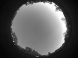
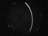
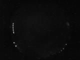
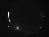
Date: June 9 2026
Time: 03:16:06.889 UTC
|
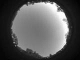
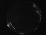
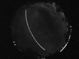
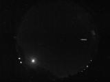
Date: June 9 2026
Time: 03:15:49.389 UTC
|

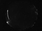
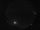
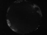
Date: June 9 2026
Time: 03:15:08.171 UTC
|
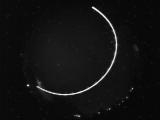
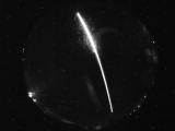
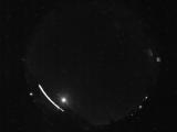
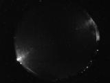
Date: June 8 2026
Time: 10:07:40.596 UTC
|
Date: June 7 2026
Time: 09:17:36.913 UTC
|
Date: June 7 2026
Time: 08:31:22.453 UTC
|
Date: June 7 2026
Time: 07:15:09.353 UTC
|
Date: June 7 2026
Time: 07:14:57.696 UTC
|
Date: June 7 2026
Time: 06:14:30.579 UTC
|
Date: June 7 2026
Time: 05:02:25.578 UTC
|

Date: June 7 2026
Time: 05:01:48.406 UTC
|
Date: June 7 2026
Time: 03:43:39.952 UTC
|
Date: June 6 2026
Time: 10:18:38.849 UTC
|
Date: June 6 2026
Time: 10:07:25.350 UTC
|
Date: June 6 2026
Time: 10:07:12.100 UTC
|
Date: June 6 2026
Time: 09:17:26.658 UTC
|
Date: June 6 2026
Time: 06:44:27.748 UTC
|
Date: June 6 2026
Time: 06:40:32.326 UTC
|
Date: June 6 2026
Time: 04:30:02.356 UTC
|
Date: June 6 2026
Time: 04:04:28.455 UTC
|
|
