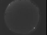
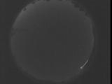
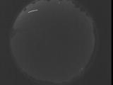
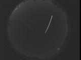
WSentinel capture software creates 3 primary event files; composite jpg, video(.mp4), and a spreadsheet(.csv) which contains a timehistory of energy, azimuth/elevation, and pixel mapping for the event as seen from the camera location: (see Spreadsheet Column Definitions here).
NOTE: The az/el data in the spreadsheet are approximations and offline calibration is required for refined assessments. Refined calibrations require use of the nightly composites which are available via the link on the right side of this page.
If you don't see an event, or you are looking for data over 30 days old, please contact us at: 
Node Events (last 30 days)
|
|

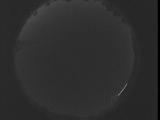
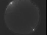
Date: September 2 2025
Time: 04:44:42.324 UTC
|

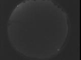
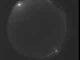
Date: September 2 2025
Time: 04:39:14.774 UTC
|
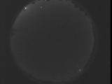
Date: September 2 2025
Time: 04:33:47.165 UTC
|
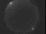
Date: September 2 2025
Time: 04:28:19.624 UTC
|

Date: September 2 2025
Time: 04:22:52.4 UTC
|

Date: September 2 2025
Time: 04:17:24.464 UTC
|

Date: September 2 2025
Time: 04:11:56.854 UTC
|
Date: September 2 2025
Time: 04:06:29.304 UTC
|
Date: September 2 2025
Time: 04:01:01.694 UTC
|

Date: September 2 2025
Time: 03:55:34.144 UTC
|
Date: September 2 2025
Time: 03:50:06.534 UTC
|
Date: September 2 2025
Time: 03:44:38.994 UTC
|
Date: September 2 2025
Time: 03:39:11.374 UTC
|
Date: September 2 2025
Time: 03:33:43.834 UTC
|
Date: September 2 2025
Time: 03:28:16.224 UTC
|
Date: September 2 2025
Time: 03:22:48.674 UTC
|
Date: September 2 2025
Time: 03:17:21.65 UTC
|
Date: September 2 2025
Time: 03:11:53.514 UTC
|
Date: September 2 2025
Time: 03:06:25.904 UTC
|
Date: September 2 2025
Time: 03:00:58.364 UTC
|
|
