WSentinel capture software creates 3 primary event files; composite jpg, video(.mp4), and a spreadsheet(.csv) which contains a timehistory of energy, azimuth/elevation, and pixel mapping for the event as seen from the camera location: (see Spreadsheet Column Definitions here).
NOTE: The az/el data in the spreadsheet are approximations and offline calibration is required for refined assessments. Refined calibrations require use of the nightly composites which are available via the link on the right side of this page.
If you don't see an event, or you are looking for data over 30 days old, please contact us at: 
Node Events (last 30 days)
|
|
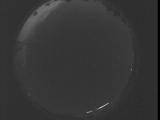
Date: September 4 2025
Time: 08:50:50.985 UTC
|
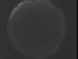
Date: September 4 2025
Time: 08:45:23.444 UTC
|

Date: September 4 2025
Time: 08:39:55.834 UTC
|

Date: September 4 2025
Time: 08:34:28.284 UTC
|

Date: September 4 2025
Time: 08:29:00.674 UTC
|
Date: September 4 2025
Time: 08:23:33.124 UTC
|

Date: September 4 2025
Time: 08:18:05.514 UTC
|

Date: September 4 2025
Time: 08:12:37.973 UTC
|

Date: September 4 2025
Time: 08:07:10.353 UTC
|

Date: September 4 2025
Time: 08:01:42.813 UTC
|

Date: September 4 2025
Time: 07:56:15.203 UTC
|

Date: September 4 2025
Time: 07:50:47.653 UTC
|

Date: September 4 2025
Time: 07:45:20.43 UTC
|

Date: September 4 2025
Time: 07:39:52.493 UTC
|

Date: September 4 2025
Time: 07:34:24.883 UTC
|

Date: September 4 2025
Time: 07:28:57.343 UTC
|

Date: September 4 2025
Time: 07:23:29.724 UTC
|
Date: September 4 2025
Time: 07:18:02.183 UTC
|

Date: September 4 2025
Time: 07:12:34.572 UTC
|

Date: September 4 2025
Time: 07:07:07.23 UTC
|
|
