WSentinel capture software creates 3 primary event files; composite jpg, video(.mp4), and a spreadsheet(.csv) which contains a timehistory of energy, azimuth/elevation, and pixel mapping for the event as seen from the camera location: (see Spreadsheet Column Definitions here).
NOTE: The az/el data in the spreadsheet are approximations and offline calibration is required for refined assessments. Refined calibrations require use of the nightly composites which are available via the link on the right side of this page.
If you don't see an event, or you are looking for data over 10 days old, please contact us at: 
Node Events (last 30 days)
|
|
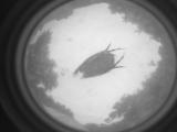
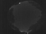
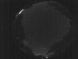
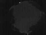
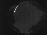
Date: June 9 2026
Time: 00:43:20.21 UTC
|
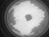
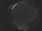
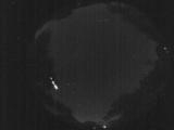
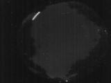
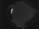
Date: June 9 2026
Time: 00:43:17.481 UTC
|
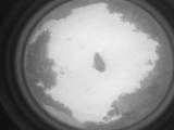
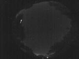
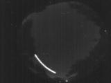
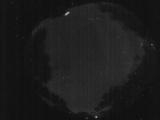
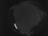
Date: June 9 2026
Time: 00:43:14.480 UTC
|
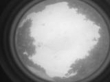
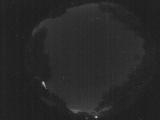
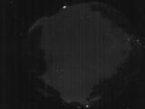
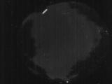
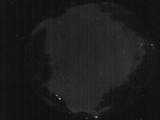
Date: June 9 2026
Time: 00:43:10.181 UTC
|
Date: June 8 2026
Time: 06:32:48.701 UTC
|
Date: June 8 2026
Time: 06:32:32.792 UTC
|
Date: June 8 2026
Time: 06:32:29.391 UTC
|
Date: June 8 2026
Time: 06:32:17.742 UTC
|
Date: June 8 2026
Time: 06:20:54.895 UTC
|
Date: June 8 2026
Time: 03:54:26.323 UTC
|
Date: June 8 2026
Time: 03:54:12.744 UTC
|
Date: June 8 2026
Time: 02:02:18.231 UTC
|
Date: June 8 2026
Time: 02:02:14.391 UTC
|
Date: June 8 2026
Time: 02:01:58.451 UTC
|
Date: June 8 2026
Time: 01:56:15.48 UTC
|
Date: June 8 2026
Time: 01:56:12.319 UTC
|
Date: June 8 2026
Time: 01:56:03.779 UTC
|
Date: June 8 2026
Time: 01:55:59.169 UTC
|
Date: June 8 2026
Time: 01:55:48.29 UTC
|
Date: June 8 2026
Time: 01:55:45.959 UTC
|
|
