Spalding Allsky Obs, Mountain View High, CA (37.3600, -122.0700, 60m) Node 17 Map Popup
Composites
WSentinel capture software creates 3 primary event files; composite jpg, video(.mp4), and a spreadsheet(.csv) which contains a timehistory of energy, azimuth/elevation, and pixel mapping for the event as seen from the camera location: (see Spreadsheet Column Definitions here).
NOTE: The az/el data in the spreadsheet are approximations and offline calibration is required for refined assessments. Refined calibrations require use of the nightly composites which are available via the link on the right side of this page.
If you don't see an event, or you are looking for data over 30 days old, please contact us at: 
Node Events (last 30 days)
|
|
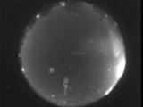
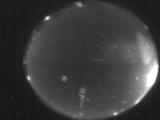
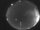
Date: September 17 2025
Time: 03:12:34.732 UTC
|
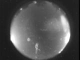
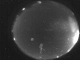
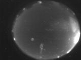
Date: September 17 2025
Time: 03:08:22.988 UTC
|
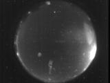
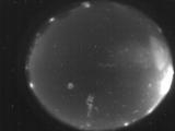
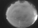
Date: September 15 2025
Time: 03:35:04.126 UTC
|
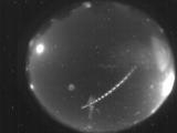
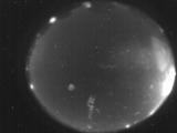
Date: September 12 2025
Time: 05:59:22.948 UTC
|

Date: September 12 2025
Time: 04:43:51.95 UTC
|

Date: September 12 2025
Time: 04:43:47.692 UTC
|

Date: September 12 2025
Time: 04:43:38.954 UTC
|

Date: September 12 2025
Time: 04:43:18.336 UTC
|
Date: September 12 2025
Time: 04:42:52.174 UTC
|
Date: September 12 2025
Time: 04:42:41.162 UTC
|
Date: September 12 2025
Time: 04:42:38.163 UTC
|

Date: September 12 2025
Time: 04:42:32.823 UTC
|

Date: September 12 2025
Time: 04:42:27.553 UTC
|

Date: September 12 2025
Time: 04:42:02.592 UTC
|
Date: September 12 2025
Time: 04:41:56.321 UTC
|
Date: September 12 2025
Time: 04:41:52.813 UTC
|

Date: September 12 2025
Time: 03:36:26.124 UTC
|
Date: September 12 2025
Time: 03:24:58.58 UTC
|

Date: September 12 2025
Time: 03:24:50.619 UTC
|
Date: September 11 2025
Time: 05:49:29.519 UTC
|
|
